
2.0 Control panel. Settings. Cartography
This tab contains mapping settings for the entire project. You can choose a specific map service for each of the following functions: geocoding, route distance calculation, and auto-complete.
Settings
- Open the Settings section in the Control panel.
- Go to the Cartography tab.
- Enter the required information.
- Click Save.
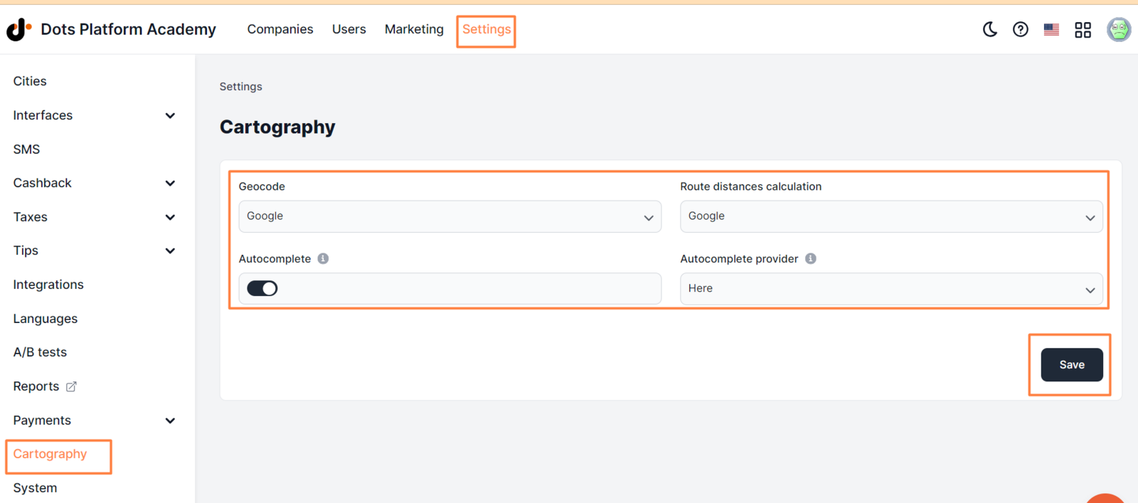
Available settings:
-
Geocode. Used to determine coordinates by address or to determine an address by coordinates. From the drop-down list, select the desired mapping service for this functionality with which the integration is configured.
-
Route distances calculation. Used to calculate the route distance for orders. From the drop-down list, select the desired mapping service for this functionality with which the integration is configured.
-
Autocomplete. The user will see a drop-down list with suggested addresses in the delivery address field when entering the address. Toggler is active - the AutoComplete functionality is enabled.
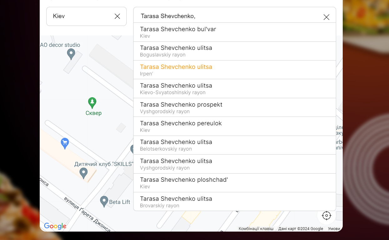
- Autocomplete provider. Select the service through which the autocomplete functionality will be performed.
Link to this article: here
Was this article helpful?
Thanks for your feedback!